
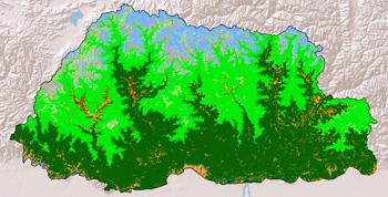
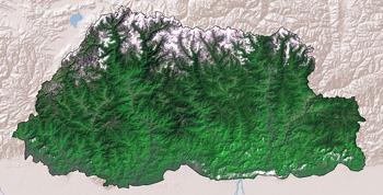
Assessment and monitoring of land cover dynamics are essential for the sustainable management of natural resources, environmental protection, biodiversity conservation, and developing sustainable livelihoods, particularly for the rural communities in the Hindu Kush-Himalayan region. The application provides easy access to the harmonised land cover database developed for Bhutan over different time slices (1990, 2000 and 2010) and provides user friendly tools for generating statistics to understand the change processes and to support the informed decisions.
The land cover data for the years 1990, 2000 and 2010 have been derived from Landsat images using object based image analysis. The legend is developed in consultation with national partners using Land Cover Classification System (LCCS) from FAO/UNEP.
The interactive application provides land cover statistics for the whole country or a selected district. The area of each land cover type can be viewed for all three years together or separately, with the option to make charts on a selected set of classes only. Change map is generated for each class showing the areas of gain or loss while the conversion to or from other classes can be seen on the chart. The land cover of different years can be viewed using a swipe tool which helps to explore the changes in a an interactive manner.